THE WORLD OF RAILROADS PROJECT

Europe
These files map railroads across Europe. They are organized by country, with some having company-specific subdivisions within the file.
Some territories and borders in Europe are contested and may shift over time. Disputed territories are organized by general Western recognition at the time the files were constructed.
Blue links will allow you to download the zip files, which can be unzipped and opened in Google Earth.
Ireland
Abbreviations:
- C&L: Cavan & Leitrim Railway
- CB&PR: Cork, Blackrock & Passage Railway
- CB&SC: Cork, Bandon & South Coast Railway
- CDRJC: County Donegal Railways Joint Committee
- CMDR: Cork & Macroom Direct Railway
- DSER: Dublin and South Eastern Railway
- GN: Great Northern Railway of Ireland
- GSWR: Great Southern & Western Railway
- LSLR: Londonderry & Lough Swilly Railway
- MGW: Midland Great Western Railway
- P&BR: Portumna & Birr Railway
- SLNCR: Sligo, Leitrim and Northern Counties Railway
- SLR: Strabane & Letterkenny Railway
- W&TR: Waterford & Tramore Railway
- WCR: West Clare Railway
United Kingdom
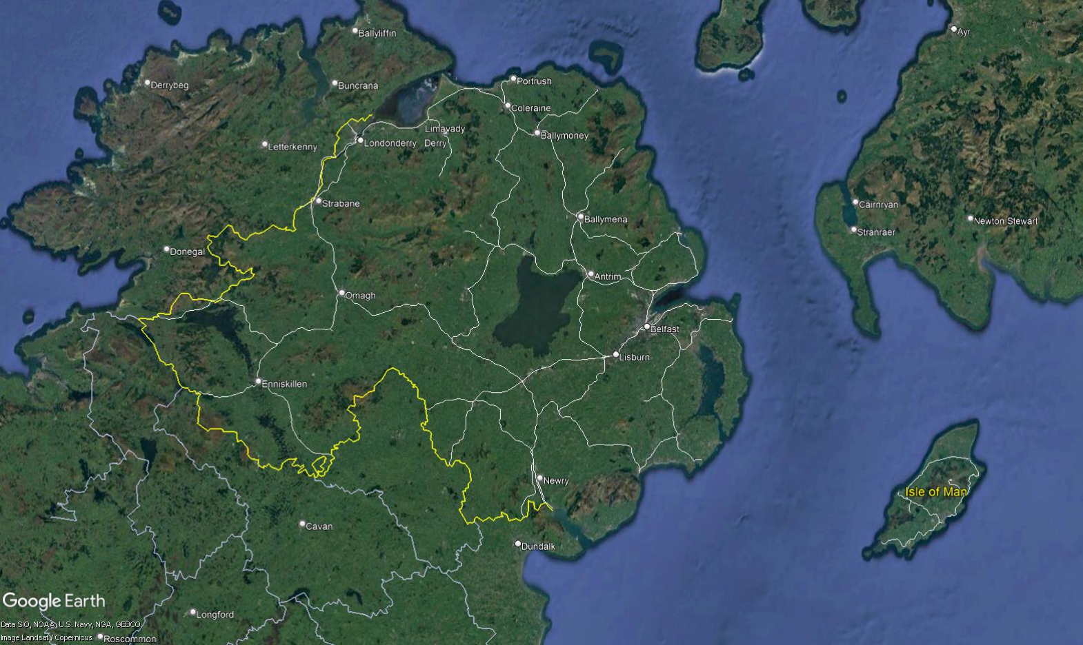
Northern Ireland
Northern Ireland Lines are broken out by the railway that last existed before nationalization into the Ulster Transport Authority or closure, with the exception of narrow gauge railways operated by the Northern Counties Committee. Per policy, tramways and very light railways like the Clogher Valley Railway have not been included.
Abbreviations:
- BCDR: Belfast and County Down Railway
- BCRB: Ballymena, Cushendall and Red Bay Railway
- BLR: Ballymena and Larne Railway
- BR: Ballycastle Railway
- CDRJC: County Donegal Railways Joint Committee
- GN: Great Northern Railway
- LSLR: Londonderry and Lough Swilly Railway
- NCC: Northern Counties Committee
- SLNCR: Sligo, Leitrim and Northern Counties Railway
Isle of Man
Abbreviations:
- IMR: Isle of Man Railway
- MER: Manx Electric Railway
- SMR: Snaefell Mountain Railway